The Chase
Another day, and the wind did not fundamentally change. The probes launching at Stuttgart were still going in the direction of Nürnberg. After checking the prediction, I decided to position myself in Rothenberg, track the probe to the ground and recover it. When driving to Rothenberg, I suddenly realized that there was a small red car with a number plate of Fürth following me. When I turned into a small street to position myself to track the probe, they set the blinker as well, but then decided to go on — the probe hunters I met yesterday were on the loose and going after today’s probe as well.
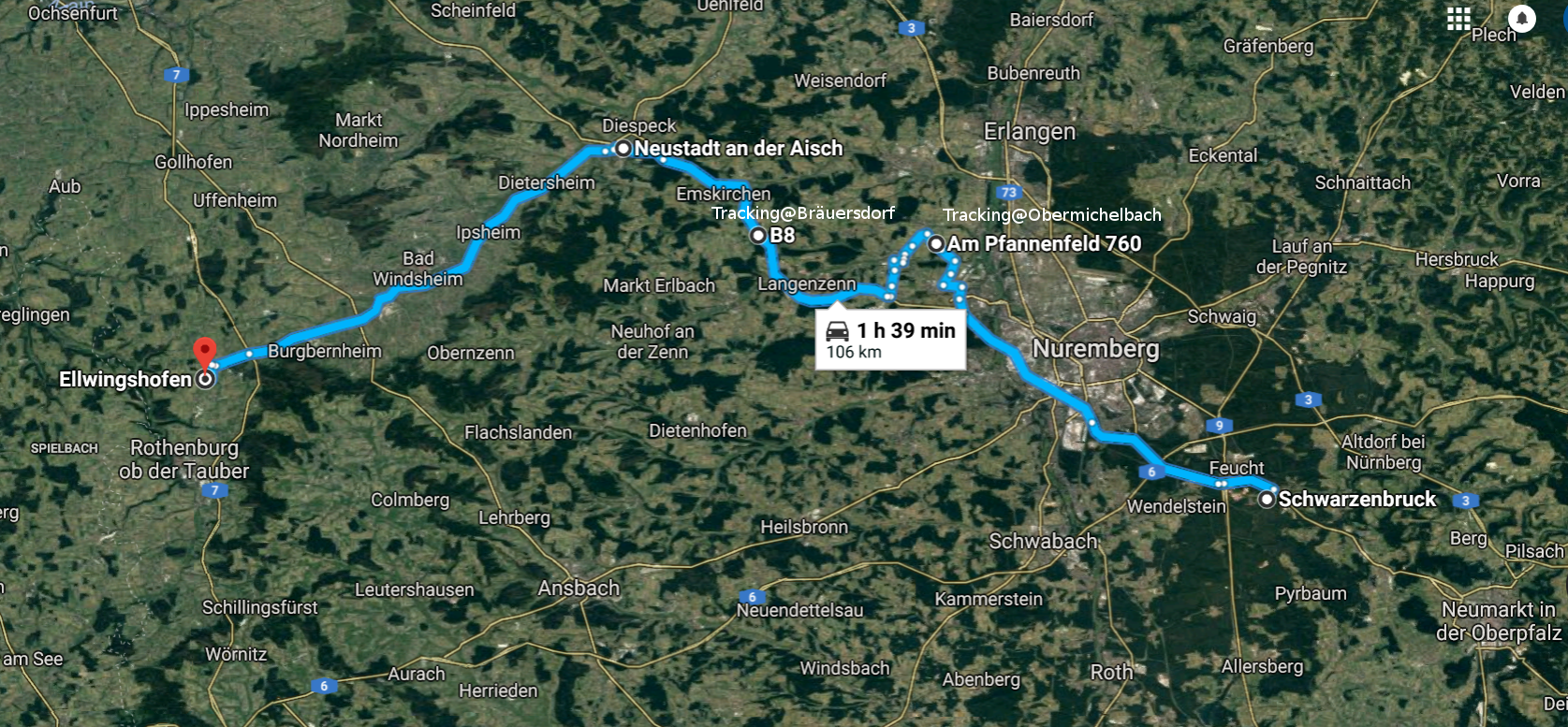
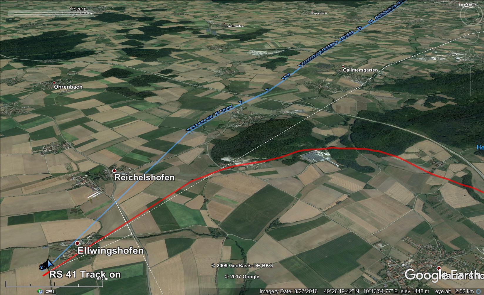
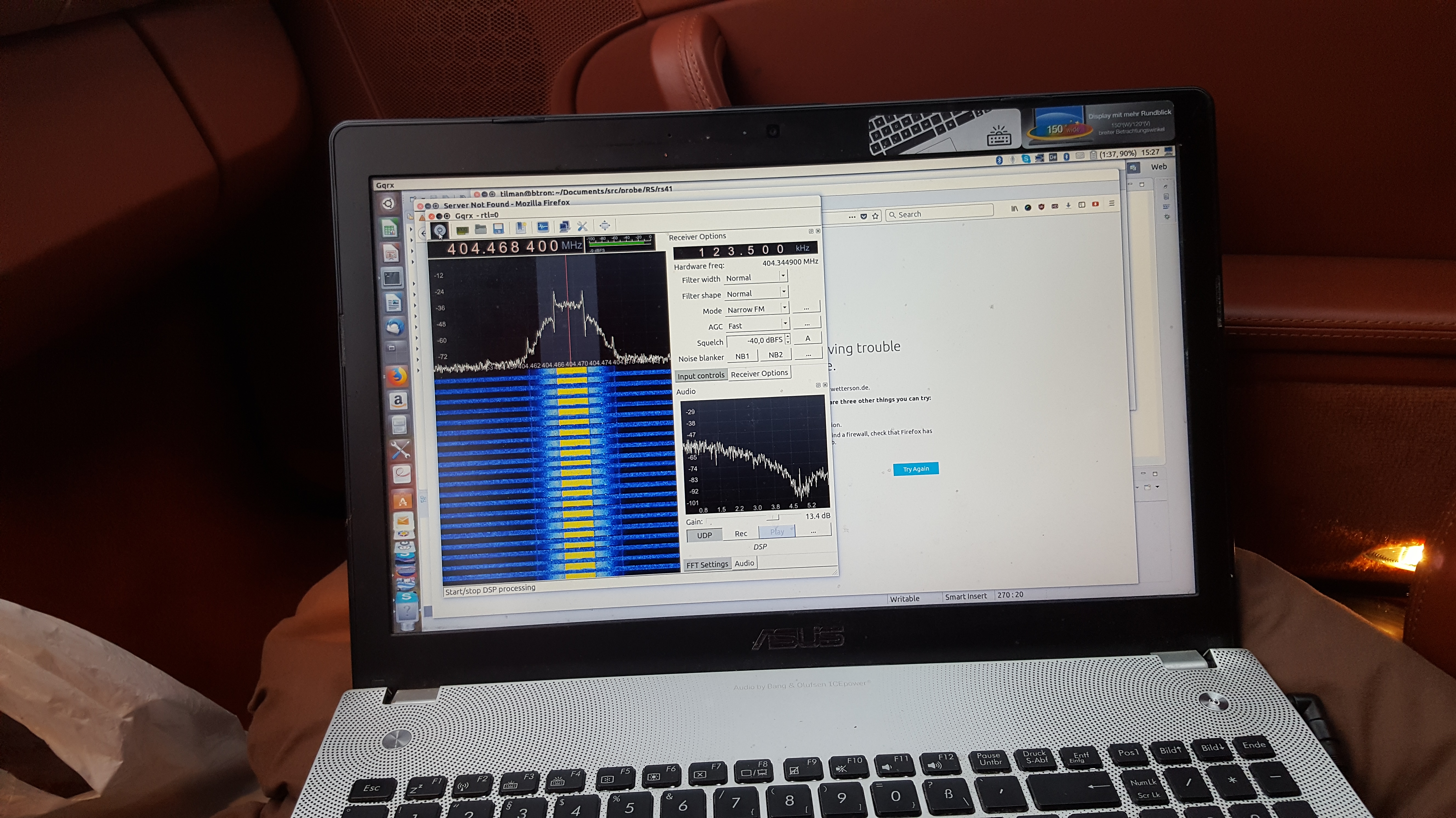
When I decoded the first packages, I found out that the probe was already on the way down. The balloon had prematurely burst in about 26 km height. As I had exceeded my data rate of my mobile phone for this month already, my provider hat reduced the data rate. Getting all the information required for a decision on how to proceed trickled in painfully slow — like in the old times with ISDN. Finally, the predictor came back with a new landing zone. The probe was to touch the ground at Burgbernheim near Rothenburg. Change of plan — I decided to continue towards Rothenburg, and once the probe was down to about 7000 m look for an elevated place, stop, and track the probe to the ground. I found a suitable place in what might have been Bräuersdorf. The probe was now already down to 4300 meter. I decoded the last telemetry in about 930m altitude — not bad considering that I was 40 km (line of sight) away.
[ 9542] (N1620293) So 2018-01-07 12:58:07.001 lat: 49.43557 lon: 10.22191 alt: 943.03 vH: 15.7 D: 257.8° vV: -3.9 # [00000]
[ 9544] (N1620293) So 2018-01-07 12:58:09.001 lat: 49.43551 lon: 10.22149 alt: 935.45 vH: 15.7 D: 258.6° vV: -3.8 # [00000]
[ 9552] (N1620293) # [01010]
lat: 49.43521 lon: 10.21941 alt: 895.77 vH: 15.1 D: 255.9° vV: -3.8 # [11010]
[ 9557] (N1620293) So 2018-01-07 12:58:22.001 # [00010]
The coordinates put the probe near Adelshofen which was 50 km more to drive. Since my connection was too slow I did not get any terrain information and could not figure out how promising an attempt to find and recover the probe would be. Nevertheless, I decided to push on.
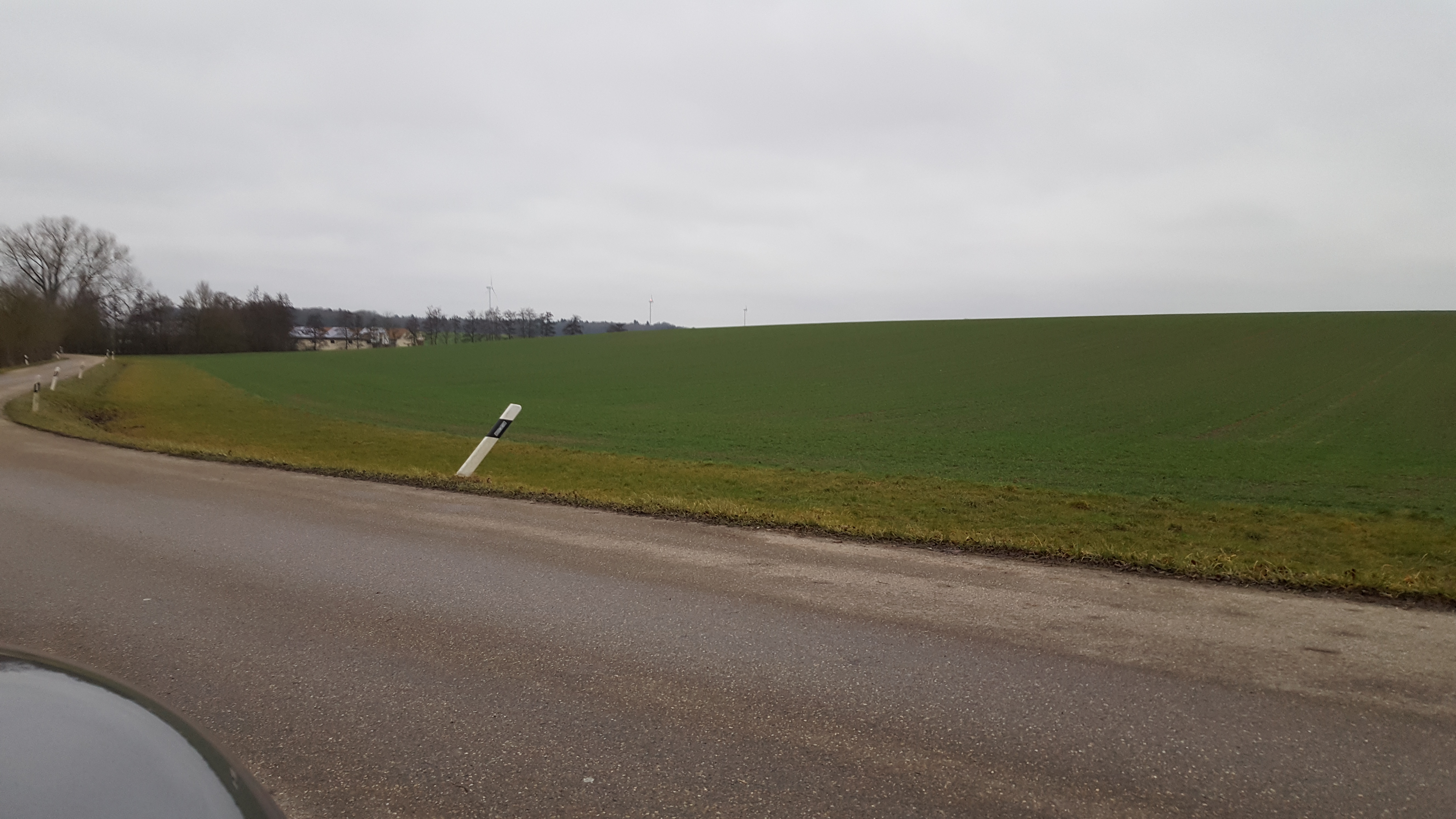
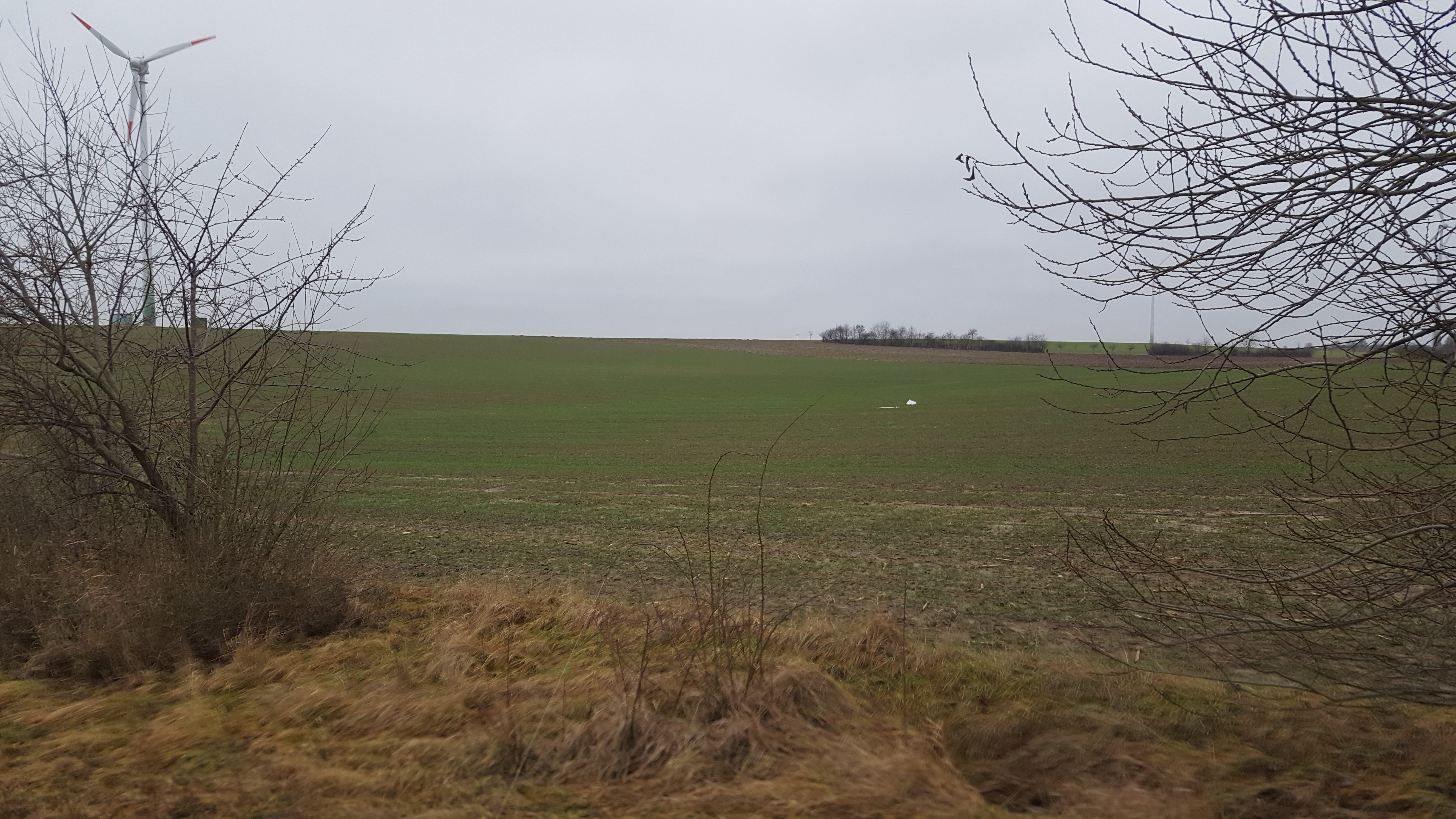
Arriving near the landing zone, I realized that the area was used as farmland — luckily no trees but windmills. I stuck an antenna out the window — and I could hear the probe. Apparently, it had fallen into a field. The field was huge and since the signal was weak, it s origin was probably not near. So it would be wise to continue by car if possible The strongest signal came from the direction of 2 windmills on the horizon.
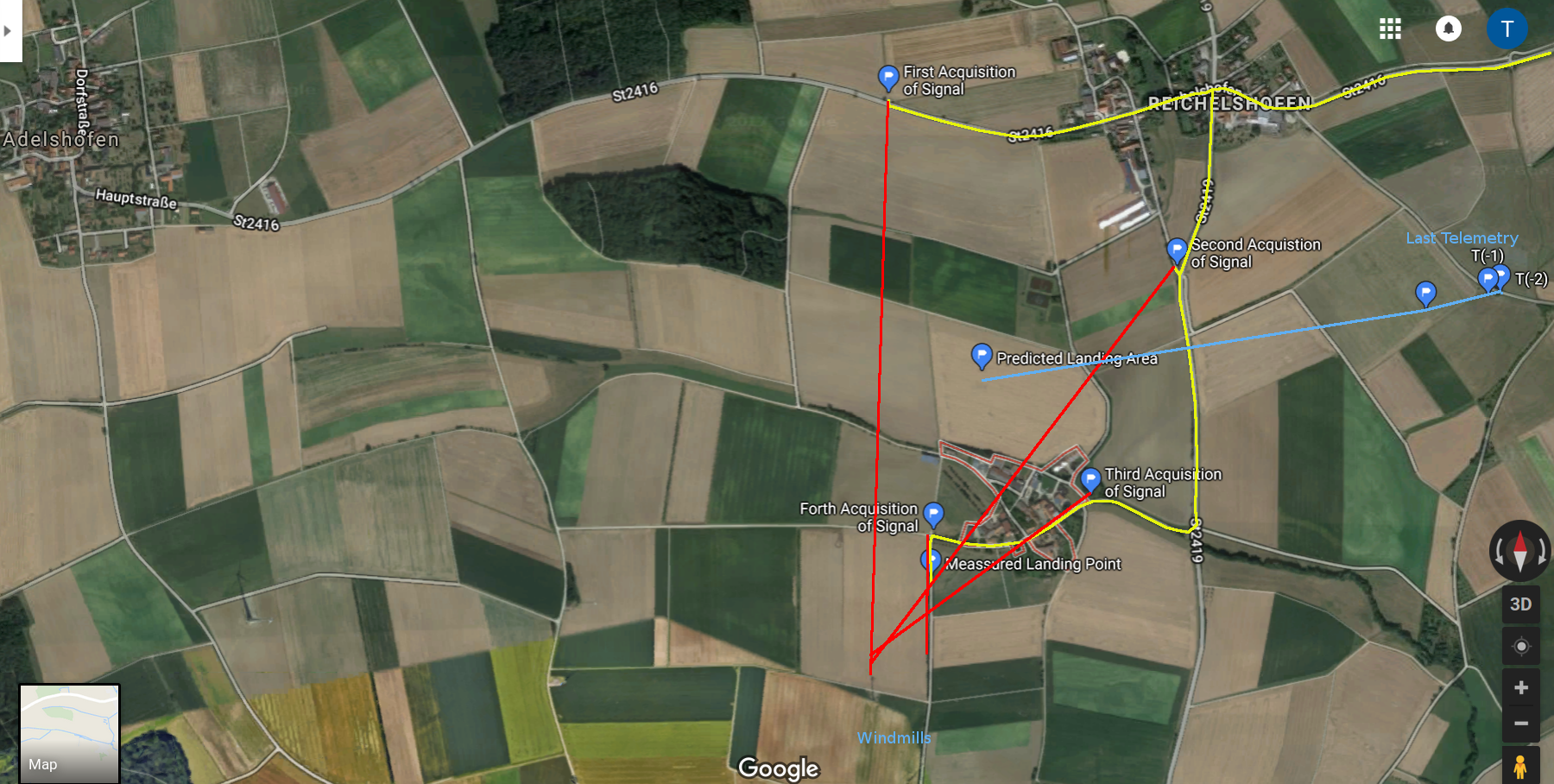
I decided to go to Ellingshofen, try to acquire the signal again, and see if it came from a different direction to narrow down its current whereabouts. When I acquired the signal for the second time, the signal still came from the windmills. With no map and no “situational awareness” , to me the direction seemed to be roughly the same as at first time. Also the signal strength had not considerably changed. I went on.
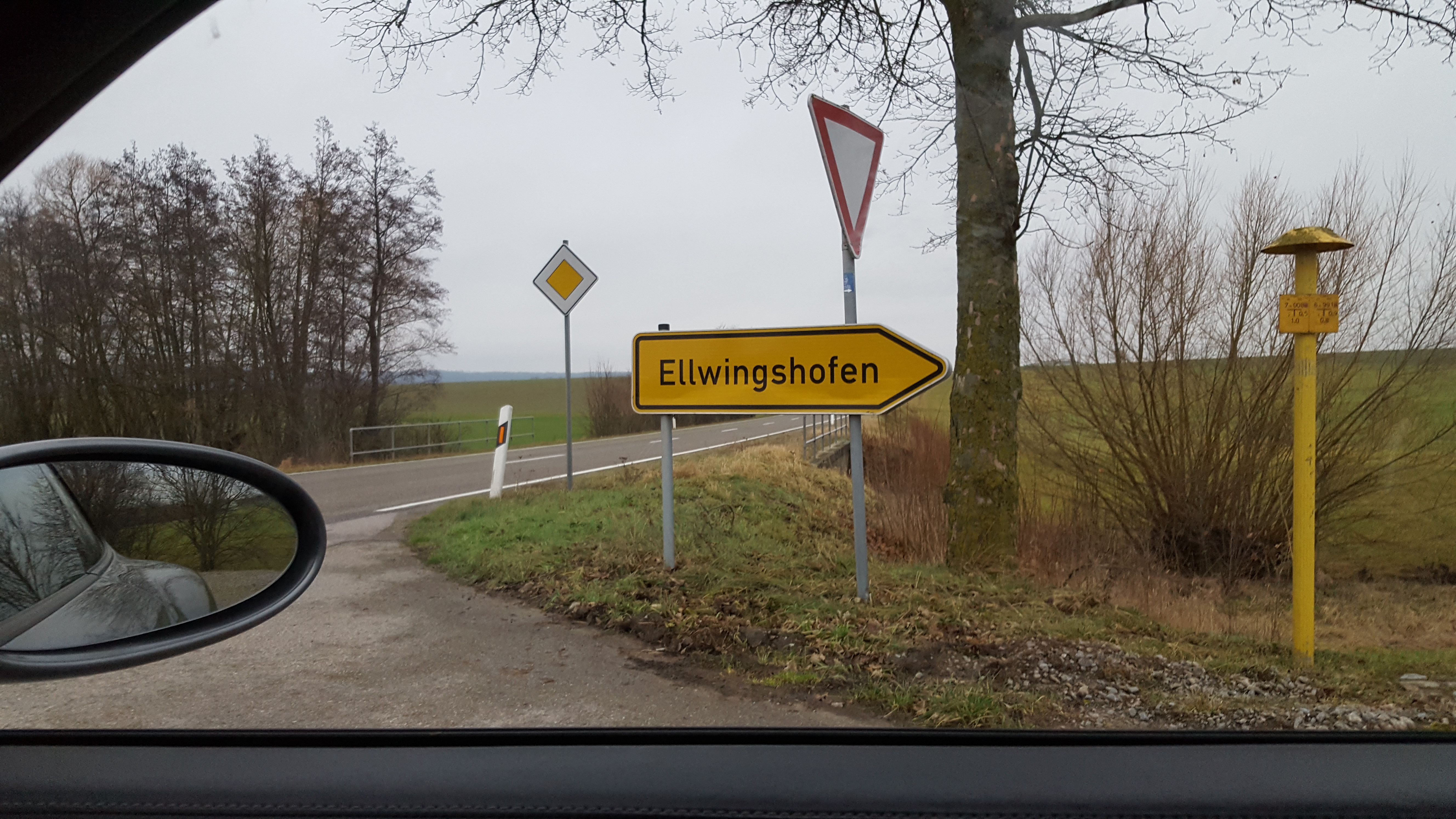
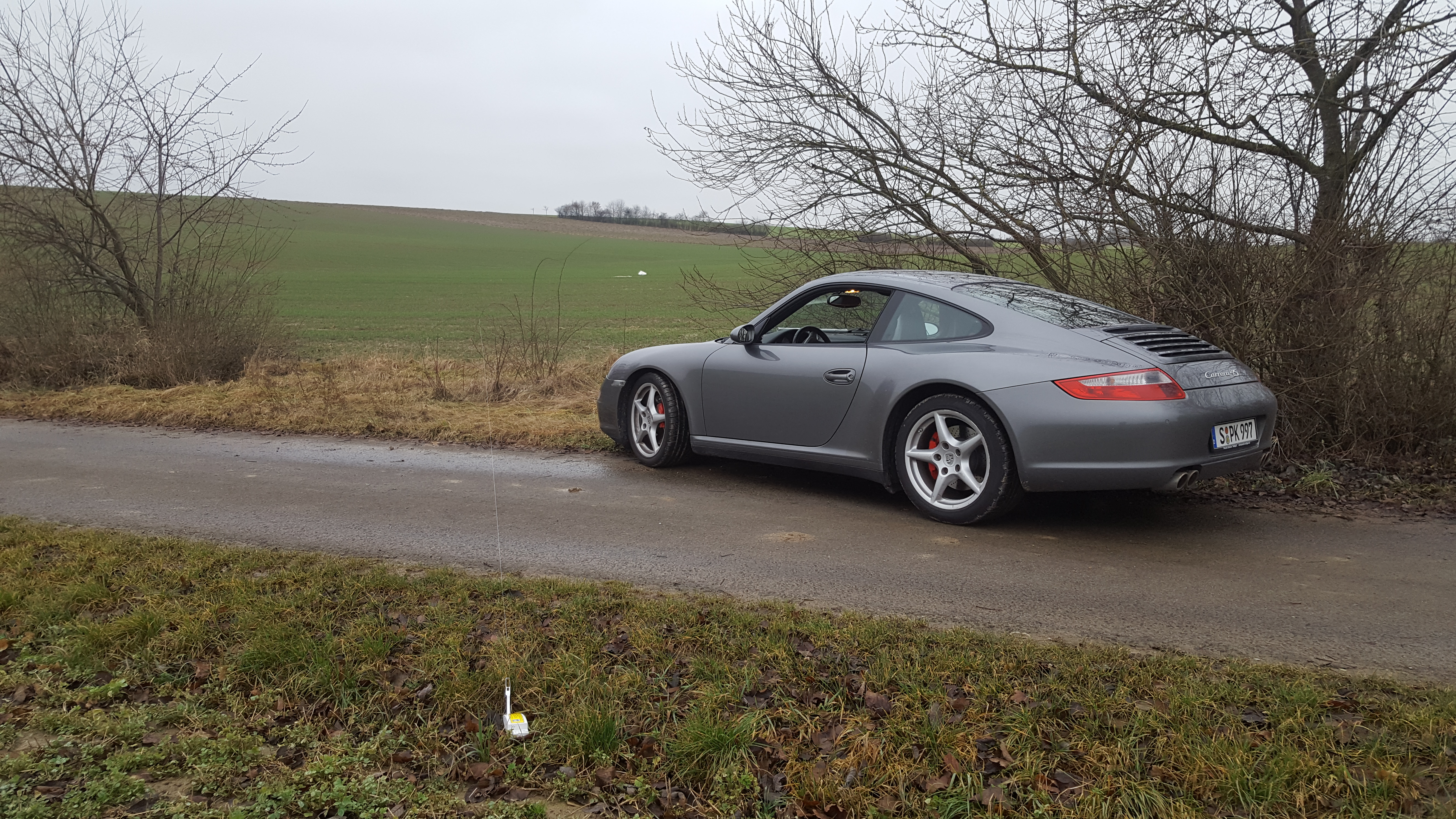
At Ellwingshofen, the signal was a lot stronger. And the direction of the strongest signal still pointed to one of the windmills. I left Ellingshofen and continued on a small tarred road. To decide whether to turn or to go straight on, I took a bearing for the forth time. Again, the signal came from near the windmills. By now, I could hear the whizzing sound of the blades cutting through the air. I turned and continued. Seconds later, I saw the parachute lying in the field as well as the thread attaching the probe with the balloon hanging across the street.
It had rained the last couple of days, the soils was soaked in water, and the clay stuck to my boots when I went to recover the parachute and the rest of the balloon.
I was almost finished when a hiker with his dog turned up looking a little bit puzzled. A guy with an antenna in the field, a car with a non-local number plate, and a funny locking thing that absolutely does not belong into that field. Torn between doubts whether my activities were legal and curiosity, he asked me about my business. I explained it to him, showed him the probe and how to receive and decode it. I had the impression he sort of liked the idea of chasing probes while his dog found his liking in the rest of the latex balloon.
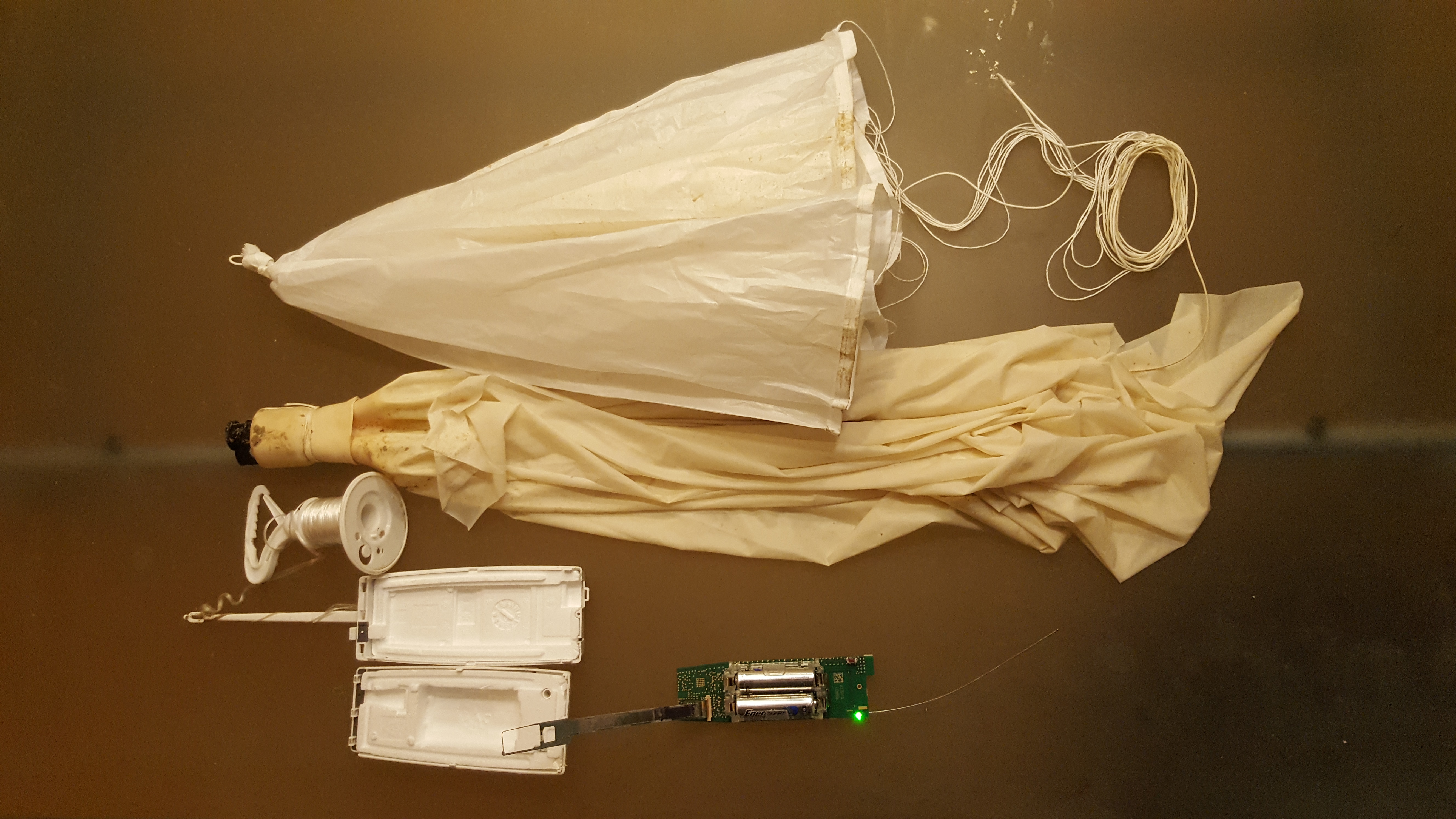
Using the emergency screw driver set of my car, I was finally able to open the probe and remove the batteries. Very content I drove back to Stuttgart.
Post Flight Analysis
At home, I scrutinized the probe. Comparing it to the RS92, Vaisala completely redesigned the probe. It consists now only of one board and a piggyback rather than 4 boards. The GPS uses a different chip set that computes the actual position on board. Also the GPS antenna is significantly smaller. The transmitter is fully integrated and relies on a single ISM-chip (ISM=radio band for industrial, scentific, or medical devices) tuned to the radio band reserved for weather probes. The sensor beam only has one sensor for humidity measurement while the RS92 has 2. And it requires only 2 batteries rather than 6 which makes the probe smaller and lighter.
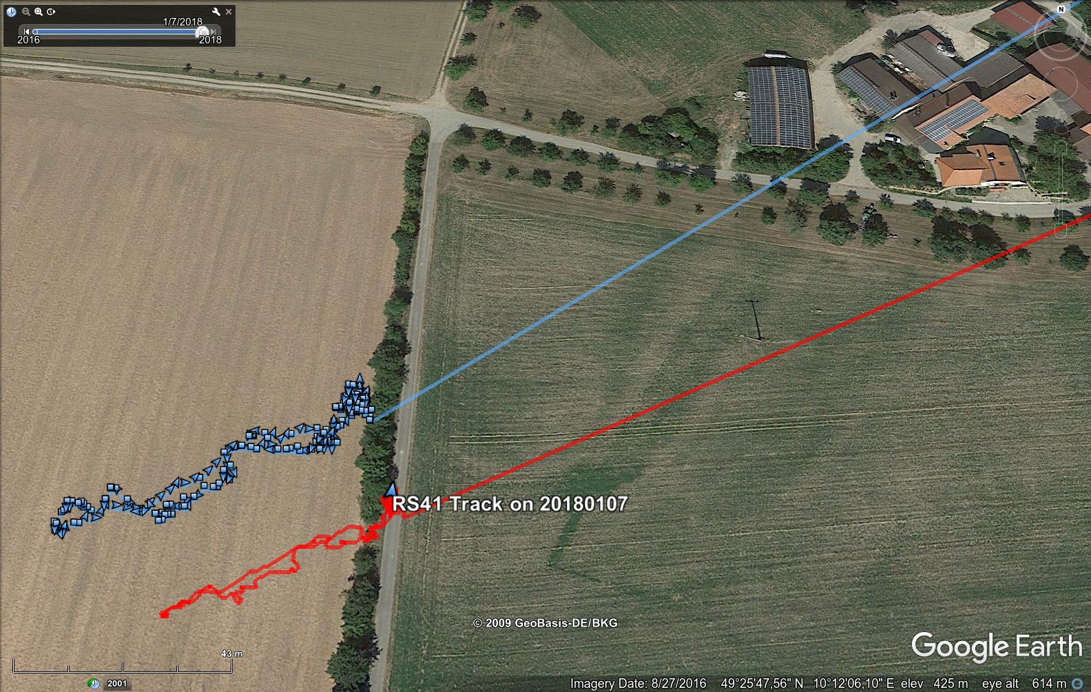
Remarkably, the position fixes of the probe on the ground were within 5 meters of the position from where I would recover the probe.
[14351] (N1620293) So 2018-01-07 14:18:16.001 lat: 49.42940 lon: 10.20294 alt: 465.82 vH: 0.1 D: 144.0° vV: -0.2 # [00000]
[14352] (N1620293) So 2018-01-07 14:18:17.001 lat: 49.42940 lon: 10.20294 alt: 465.83 vH: 0.0 D: 159.0° vV: -0.3 # [00000]
[14353] (N1620293) So 2018-01-07 14:18:18.001 lat: 49.42941 lon: 10.20294 alt: 466.48 vH: 0.0 D: 203.4° vV: -0.1 # [00000]