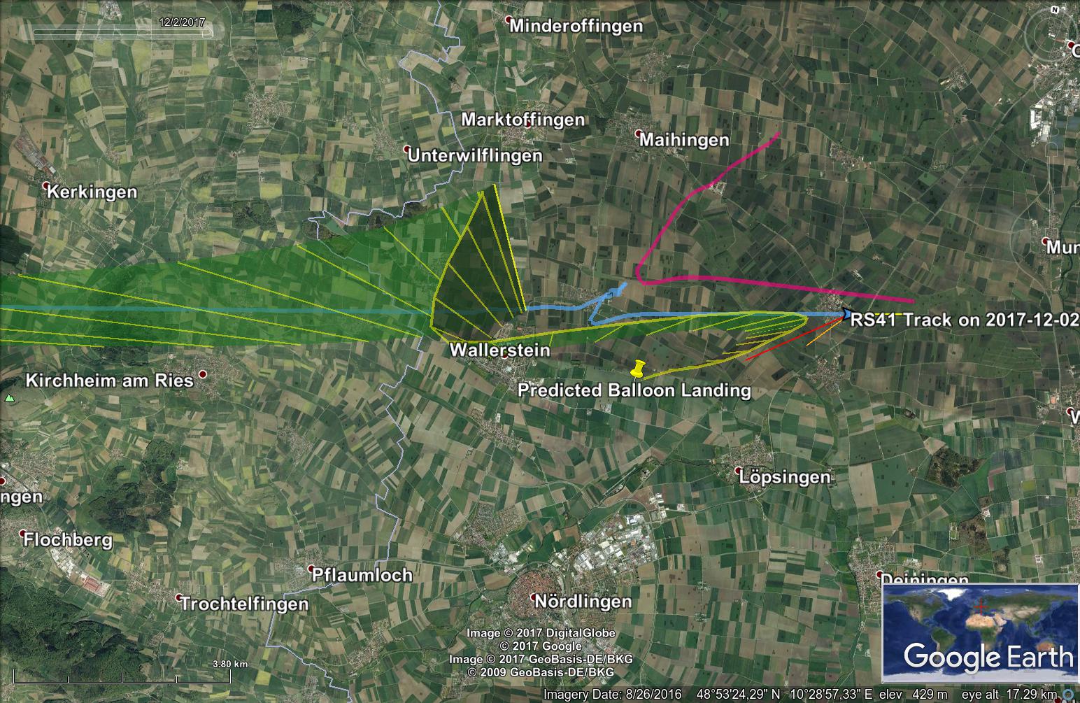
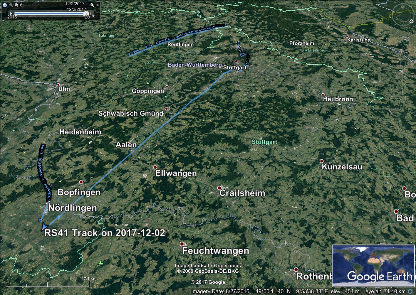
Felix and myself went out in our next attempt to hunt down a balloon probe. The probe started in Stuttgart at 10:45 Zulu Time. Assuming a burst altitude of 26 km, the landing predictor placed the landing site somewhere near Heubach/Schwäbisch Gmünd. We went there with our chase car and waited there. Using new gadgets, i.e. preamplifiers, the signal was strong and we could decode it well. The balloon however refused to burst, and the probe continued ascending. Once the altitude had reached 29 km and the balloon still climbed, we queried the predictor for a probable landing site. It came back with a landing site somewhere between Bopfingen and Nördlingen. We decided to continue driving toward Nördlingen as the probe had overtaken us by this time on its way east and was still climbing strong.
We then stopped at a resting area near Nördlingen, acquired the signal of the probe and decoded it. The last telemetry packages we received before the probe hit the ground looked like below and placed the probe near Pfäfflingen (yes, I also did not know about the existence of this village until now). At this point in time, we were about 45 km away. Here the last to decoded packages.
[ 7841] (N3450059) Sa 2017-12-02 12:29:49.000 lat: 48.89863 lon: 10.50844 alt: 6744.71 vH: 19.5 D: 80.2° vV: -15.6 # [00000]
[ 7842] (N3450059) Sa 2017-12-02 12:29:50.000 # [00010]
[ 7843] (N3450059) Sa 2017-12-02 12:29:51.000 lat: 48.89869 lon: 10.50897 alt: 6717.07 vH: 19.5 D: 79.2° vV: -13.3 # [00000]
[ 7844] (N3450059) Sa 2017-12-02 12:29:52.000 # [00010]
[ 7995] (N3450059) # [01010]
[ 8093] (N3450059) # [00110]
[ 8102] (N3450059) Sa 2017-12-02 12:34:10.000 lat: 48.90320 lon: 10.55659 alt: 3330.95 vH: 2.6 D: 226.3° vV: -13.3 # [00000]
Sa 2017-12-02 12:34:11.000 lat: 48.90318 lon: 10.55656 alt: 3317.86 vH: 3.2 D: 224.4° vV: -13.2 # [11000]
[ 8115] (N3450059) # [01010]
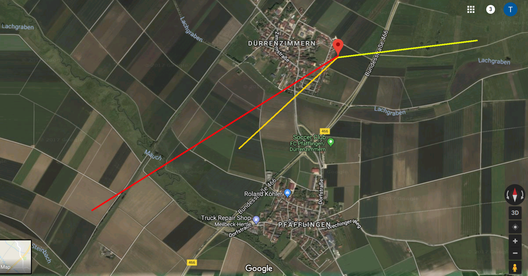
Somehow in my excitement (and probably not wearing my glasses), I overlooked the last transmitted direction, and assumed that the probe continued to travel around 80° eastbound. This would placed the landing location east of Dürrenzimmern, i.e. somewhere along the yellow line on the picture below.
time_until_landing = (AltitudeOfProbe – AltitudeOfPfäfflingen) / v_vertical =(3300m – 418m)/13m/s=221s.
distance_traveled_@80° = time_until_landing * v_horizontal = 221s*3,2m/s=709m.
So once we arrived in the drop down area some 40 minutes later, Felix and myself searched along the yellow line to no avail. It was cold, the meadow was muddy and wet — and so were our shoes in no time. I remember wondering that the wind came from the east, i.e. in the direction I assumed the probe to have traveled. I however did not draw the right conclusion, and assumed that the wind had turned within the 40 minutes it had taken us to arrive after having received the last telemetry package of the probe. At one point, we mistook a big mushroom covered with snow as the probe. We found a raised stand, climbed to the top and tried to acquire a signal from an elevated position. Nothing but static from the radio… It remains to say that the stand was almost comfortably furnished with carpets and protected us from the wind chill — we however stayed only very briefly as animals had left their markings in form of now dried and frozen droppings.
A little bit frustrated but with intention to give it another go, we jumped in our car and went back to Stuttgart.
“Postflight analysis” revealed 2 things:
1) The last travel direction transmitted was 224°. Using the calculation above, the probe probably has landed somewhere along the orange line.
2) The shape of the measured ground track was consistent with the prediction. The actual position was however off by a constant offset. Using the predicted path and propagating it starting from the last measured position (red marker) would place the landing location somewhere along the red line.